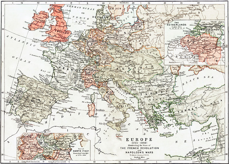
Description: This is a map of Europe illustrating the Wars of the French Revolution and Napoleon's Wars, 1715 to 1830. Shows countries and major cities of the time, major river ways, topography and political boundaries. Scale in English miles. The insert on the bottom left of the map shows part of North Italy illustrating campaigns of 1794 to 1800. The insert in the top right shows the Netherlands and Belgium.
Place Names: A Complete Map of Europe, France, �Portugal, �Spain, �Italy, �Sweden, �United Kingdom, �Prussia, �Russia, �Austria, �Netherlands, �Belgium, �Turkey, �Egypt, �Mediterranean Sea, �Greece, �Africa, �Atlantic Ocean, �North Sea, �Black Sea, �Rhone River, �River Thames, �Denmark, �Ba
ISO Topic Categories: boundaries,
elevation,
inlandWaters,
oceans,
transportation
Keywords: Europe illustrating the Wars of the French Revolution and Napoleon's Wars, physical, �political, �transportation, �historical, kNapoleonBonaparte, physical features,
topographical, country borders,
major political subdivisions, water routes, boundaries,
elevation,
inlandWaters,
oceans,
transportation, Unknown, 1715–1830
Source: Keith Johnston, The Half-Crown Atlas of British History (Edinburgh, Scotland: W. & A. K. Johnston, 1871) 23, 24
Map Credit: Courtesy the private collection of Roy Winkelman |
|