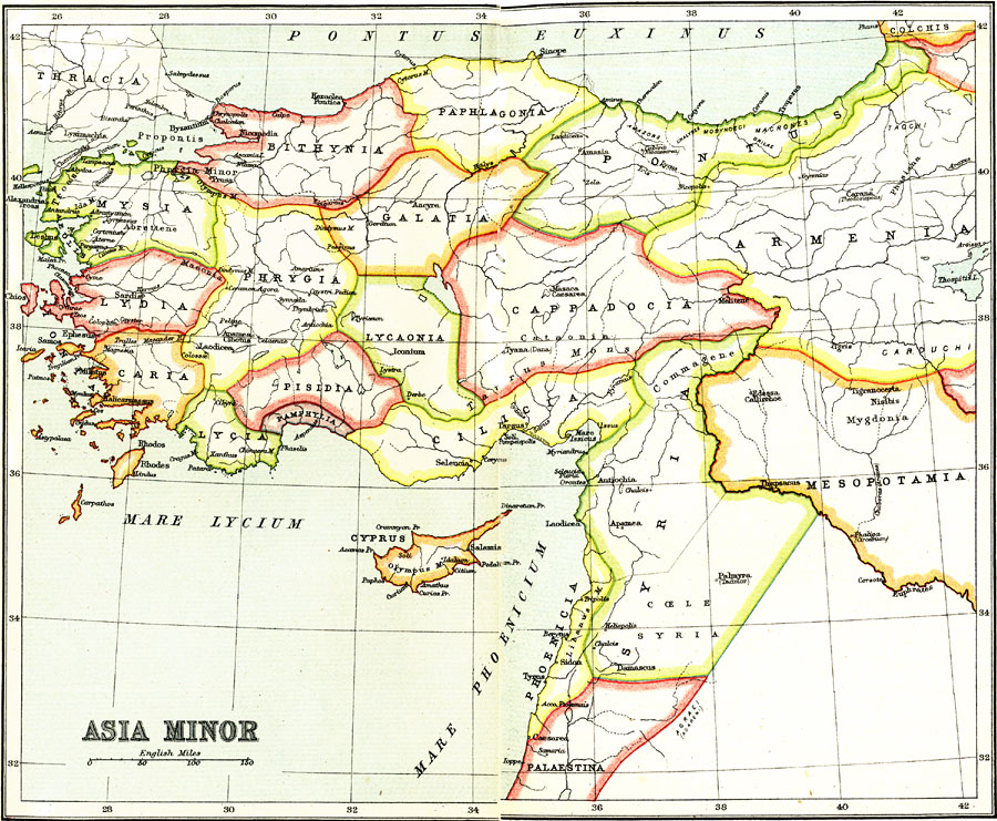
Description: A map of Asia Minor showing the kingdoms and provinces that existed from about 1150 BC to 550 BC, before being conquered by the Persian Empire. The map shows the territories of Mysia, Lydia, Caria and the islands along the &Aelig;gean, Bithynia, Paphlagonia, and Pontus along the Pontus Euxinus (Black Sea), Lycia, Pamphylia, Pisidia, and Cilicia along Mare Lycium (part of the Mediterranean), the inland territories of Phrygia, Galatia, Lycaonia, Cappadocia, and the western portions of Armenia and Mesopotamia, Syria, Phoenicia, the island of Cyprus, and northern portion of Palestina along the Mare Phoenicium. The map shows important cities in ancient history, ports, districts, lakes, rivers, and coastal features.
Place Names: Southwest Asia, Bithynia, �Galatia, �Mysia, �Lydia, �Caria, �Lycia, �Cyprus, �Armenia, �Pontu
ISO Topic Categories: structure
Keywords: Asia Minor, historical, �political, country borders,
major political subdivisions, structure, Unknown, 1150–550 BC
Source: Ernest Rhys, Ed., A Literary and Historical Atlas of Asia (New York, NY: E.P. Dutton & CO., 1912) 10
Map Credit: Courtesy the private collection of Roy Winkelman |
|