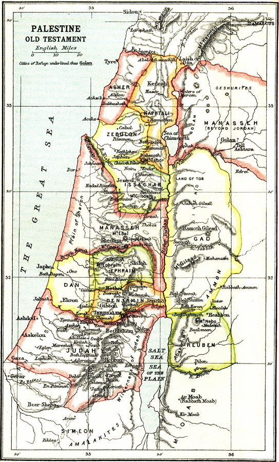
Description: A map of Palestine during the Old Testament Era, approximately 1020 BC (Saul the King) to 586 BC (destruction of the First Temple by the Babylonians). The map shows the divisions of the region according to the Twelve Tribes of Israel, including Asher, Naphtali, Zebulon, Issachar, Manasseh, Ephraim, Dan, Benjamin, Judah, Simeon, Gad, and Ruben. Biblically significant (Old Testament) cities, rivers, mountains, and other sites in the region are shown.
Place Names: Palestine, Judah, �Reuben, �Manasseh, �Asher, �Ephriam, �Benjamin, �Jerusale
ISO Topic Categories: society
Keywords: Palestine, physical, �political, �historical, physical features,
topographical, society, Unknown, Old Testament Times
Source: Ernest Rhys, Ed., A Literary and Historical Atlas of Asia (New York, NY: E.P. Dutton & CO., 1912) 12
Map Credit: Courtesy the private collection of Roy Winkelman |
|