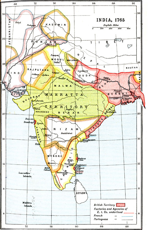
Description: A map of India in 1765, showing the provinces at the time, the extent of the Mahratta territory, and outlining the British territory and the beginning of British India after the Battle of Buxor (1764). The Seven Years War in Europe (1756–1763) renewed British and French hostilities in India, and the British East India Company became increasingly militaristic, as shown by the battle sites indicated on this map. Dates of significant battles are given, and the map shows the British territories in red, with cities, ports, and trade centers under British, French, and Portuguese control denoted by respective underlined names.
Place Names: Southern Asia, India, �Nepal, �Tibet, �Nizam, �Mogul, �Punja
ISO Topic Categories: society
Keywords: India, political, �historical, major political subdivisions, society, Unknown, 1765
Source: Ernest Rhys, Ed., A Literary and Historical Atlas of Asia (New York, NY: E.P. Dutton & CO., 1912) 19
Map Credit: Courtesy the private collection of Roy Winkelman |
|