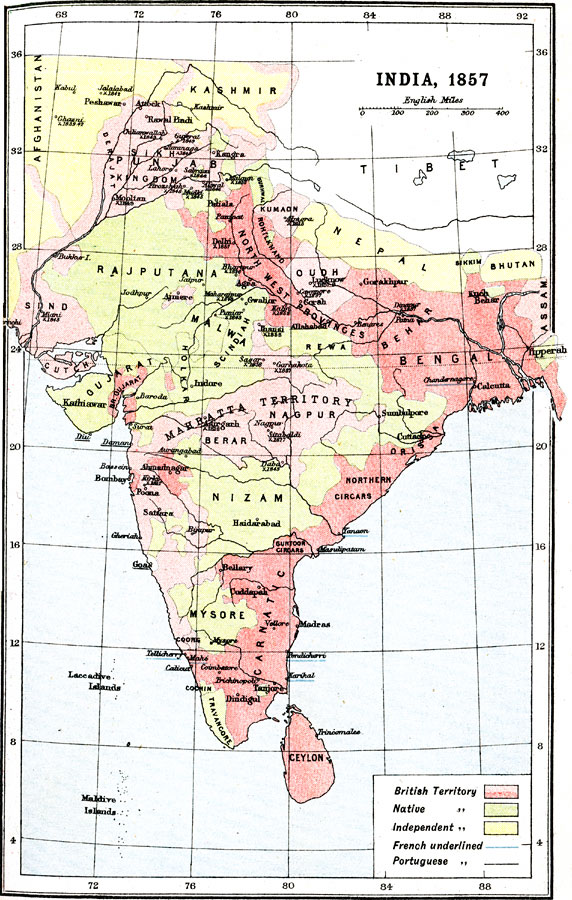
Description: A map of India at the time of the Indian Rebellion of 1857 (First War of Independence), showing the provinces at the time, the extent of the Mahratta (Maratha) territory (under British control), and the British held territories. This map is color-coded to show the territories under British control in red, the native territories in green, and the independent territories at the time in yellow. Dates of significant battles are given, and the map shows the cities, ports, and trade centers under French and Portuguese control denoted by respective underlined names.
Place Names: Southern Asia, Nepal, �India, �Afghanistan, �Kashmir, �Nizam, �Benga
ISO Topic Categories: society
Keywords: India, historical, �political, major political subdivisions, society, Unknown, 1857
Source: Ernest Rhys, Ed., A Literary and Historical Atlas of Asia (New York, NY: E.P. Dutton & CO., 1912) 21
Map Credit: Courtesy the private collection of Roy Winkelman |
|