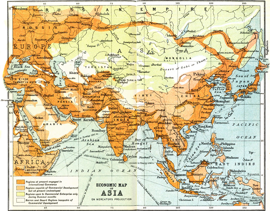
Description: A map from 1912 of Asia on a Mercator's Projection, illustrating commercial development of the region at the time. This map is color-coded to show the regions engaged in international commerce, those capable, but undeveloped, those regions open to commercial enterprise only during summer months and those barren or desert regions incapable of commercial development. The map shows the heavier development of southern Asia, and the low development of interior central and northern Asia, with the exception of the area immediately along the Trans–Siberian and Trans–Manchurian railroad network. The map shows the railways in the region, with connecting routes to the European railway network, and steamship routes with distances between major ports given in nautical miles. The map shows major cities and trade centers, caravan routes, ports, lakes and seas, rivers, and coastal features.
Place Names: Miscellaneous Asia, Russia, �Thailand, �India, �Japan, �Kazakhstan, �Mongolia, �Pakistan, �Philippines, �China, �Indonesi
ISO Topic Categories: economy
Keywords: Economic Activity in Asia, kEconomic, economy, Mercator, 1912
Source: Ernest Rhys, Ed., A Literary and Historical Atlas of Asia (New York, NY: E.P. Dutton & CO., 1912) 40
Map Credit: Courtesy the private collection of Roy Winkelman |
|