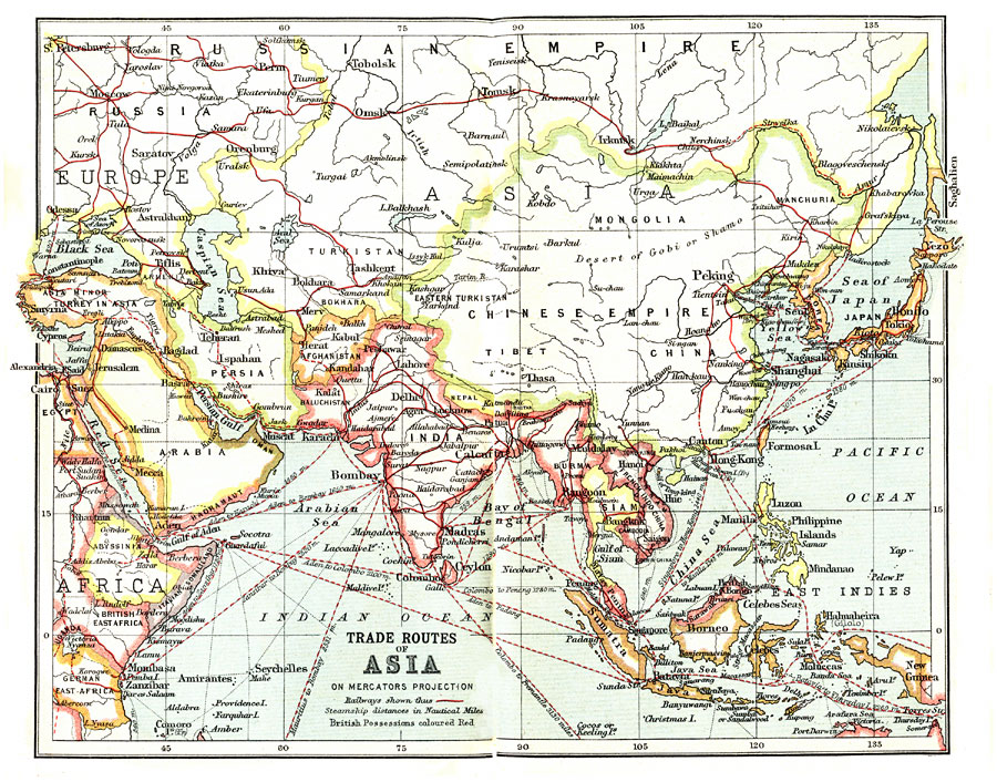
Description: A map from 1912 on a Mercator's Projection showing trade routes in Central and Southern Asia, including the railways in the region with connections to the European railway network, as well as primary and secondary steamship routes with distances between major ports given in nautical miles. The map shows major cities and ports, terrain, rivers, and coastal features, with the British possessions at the time outlined in red.
Place Names: Miscellaneous Asia, China, �India, �Indonesia, �Japan, �Kazakhstan, �Mongolia, �Pakistan, �Philippines, �Russia, �Thailan
ISO Topic Categories: transportation,
society
Keywords: Trade Routes of Asia, transportation, �political, country borders, railroads,
water routes, transportation,
society, Mercator, 1912
Source: Ernest Rhys, Ed., A Literary and Historical Atlas of Asia (New York, NY: E.P. Dutton & CO., 1912) 42
Map Credit: Courtesy the private collection of Roy Winkelman |
|