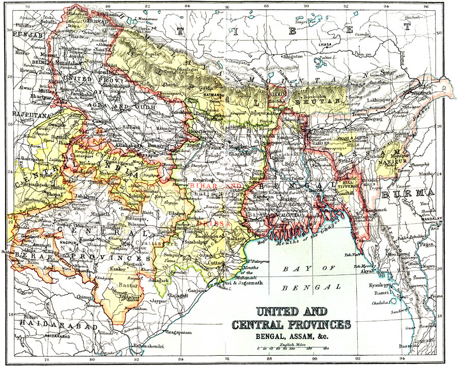
Description: A map from 1912 of the British provinces of Bengal, Assam, Bihar and Orissa, Central India and the United Provinces of Agra and Oudh at the time. The map also shows the countries of Nepal and Bhutan, and the Indian state of Sikkim. The map shows province capitals and major cities, railways, terrain, rivers, and coastal features of the region.
Place Names: India , Central India, �Bihar, �Bengal, �Assa
ISO Topic Categories: society
Keywords: United and Central Provinces of India, political, �historical, country borders,
major political subdivisions, society, Unknown, 1912
Source: Ernest Rhys, Ed., A Literary and Historical Atlas of Asia (New York, NY: E.P. Dutton & CO., 1912) 60
Map Credit: Courtesy the private collection of Roy Winkelman |
|