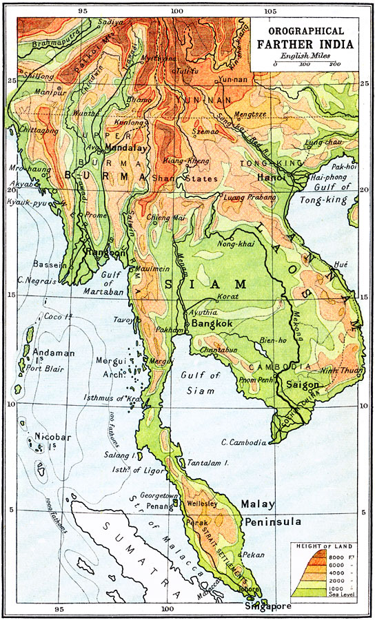
Description: An orographical map from 1912 of the area once called Farther India or Southwest Asia. This map uses color-contours to show general land elevations ranging from sea level to above 8000 feet, and gives the 100 fathom contour line to show the submerged continental plateau. The map shows capitals and major cities, ports, existing and proposed railways, rivers, and coastal features, and the general territories of Burma (Myanmar), Siam (Thailand), Yunnan, Tonking, Annam, Laos, Cambodia, Cochin China, and the British Strait Settlements on the Malay Peninsula.
Place Names: Southeastern Asia, Siam, �Laos, �Burma, �Hanoi, �Bangko
ISO Topic Categories: elevation
Keywords: Farther India, Orographical, physical, physical features,
topographical, elevation, Unknown, 1912
Source: Ernest Rhys, Ed., A Literary and Historical Atlas of Asia (New York, NY: E.P. Dutton & CO., 1912) 66
Map Credit: Courtesy the private collection of Roy Winkelman |
|