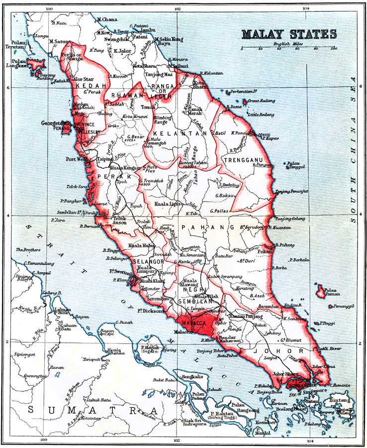
Description: A map from 1912 showing the political boundaries of the southern Malaysian Peninsula at the time, including the British possessions of the Straits Settlements (Malacca, Penang, Dindings, and Province Wellesley). The map shows the Malay States, major cities and ports, railways, rivers, coastal features, and islands.
Place Names: Southeastern Asia, Johor, �Malacca, �Pahang, �Kelantan, �Kedah, �Pera
ISO Topic Categories: society
Keywords: Malay States, political, �physical, physical features, major political subdivisions, society, Unknown, 1912
Source: Ernest Rhys, Ed., A Literary and Historical Atlas of Asia (New York, NY: E.P. Dutton & CO., 1912) 68
Map Credit: Courtesy the private collection of Roy Winkelman |
|