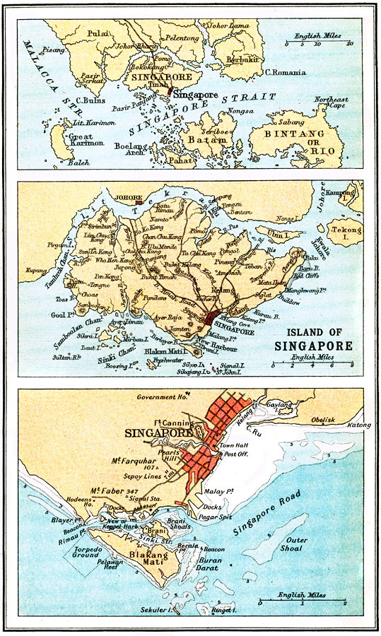
Description: A series of three maps from 1912 of the island of Singapore. At the time, Singapore was a British colony on the busy shipping routes between Europe and China. The top map shows the island in relation to the southern tip of the Malayan Peninsula, the Malacca and Singapore straits, the road connection to the mainland and north, and the neighboring islands of Bintang or Rio, Batam, Pahat, and Great Karimon. The middle map details the island of Singapore, showing the Silit Tekrau (Tebrau Strait or Johor Strait) and the Tambroh Channel separating the island from the mainland, the hills and terrain, the Bukit Timah Road and other roads, rivers, and the city of Singapore and neighboring villages. The bottom map details the area around the city of Singapore, showing the harbor area and torpedo grounds with water depths given in fathoms, nearby hills with elevations, the major thoroughfares, government buildings, and military installations, including Fort Canning and the Sepoy (Indian soldiers) lines.
Place Names: Singapore, Singapor
ISO Topic Categories: society,
transportation
Keywords: Island of Singapore, physical, �transportation, physical features, society,
transportation, Unknown, 1912
Source: Ernest Rhys, Ed., A Literary and Historical Atlas of Asia (New York, NY: E.P. Dutton & CO., 1912) 78
Map Credit: Courtesy the private collection of Roy Winkelman |
|