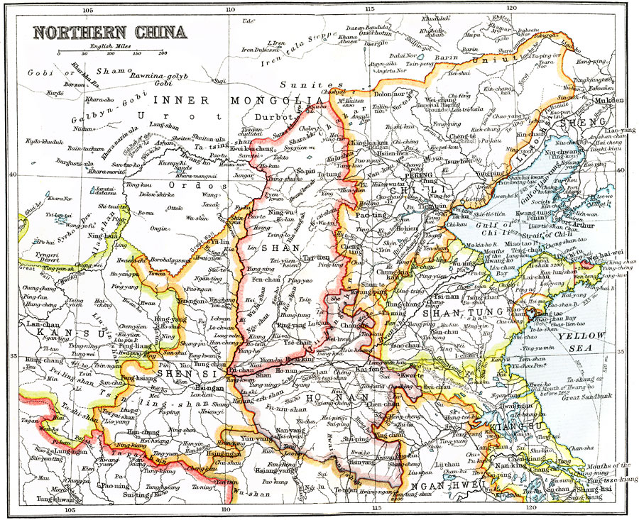
Description: A map from 1912 of the northern Chinese provinces at the end of the ruling Qing Dynasty. The map shows the political boundaries of the time, foreign possessions, provincial capitals, major cities, ports, railways, steamship routes with distances between major ports given in nautical miles, lakes, rivers, and coastal features.
Place Names: China, Kansu, �Shensi, �Shansi, �Honan, �Chi Li, �Shan Tun
ISO Topic Categories: society
Keywords: Northern China, political, �physical, physical features, major political subdivisions, society, Unknown, 1912
Source: Ernest Rhys, Ed., A Literary and Historical Atlas of Asia (New York, NY: E.P. Dutton & CO., 1912) 82
Map Credit: Courtesy the private collection of Roy Winkelman |
|