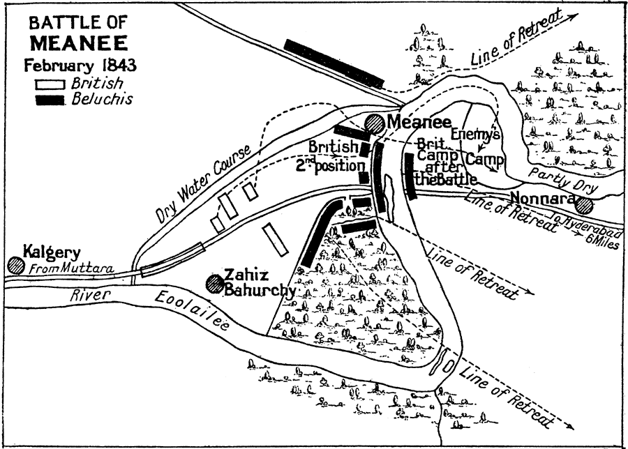
Description: A sketch map of the Battle of Meanee (Meeanee or Miani), fought on 17 February 1843 between the Talpur (Beluchis or Balochi) Amirs of Sindh and British forces under Sir Charles Napier during the conquest of the Sindh (now Pakistan) by the British East India Company. The map shows the encampment of the Beluchis along the River Eoolailee and military positions near the city of Meanee, the British initial positions from Kalgery and Zahiz Bahurchy, their advance toward Meanee, and the Beluchis line of retreat routes. The decisive British victory led to the annexation of Sindh into the sphere of British India.
Place Names: India , Meanee, Miani, Kalgery, River Eoolailee
ISO Topic Categories:
Keywords: Battle of Meanee, historical, kBattle, other military, Unknown, February 17, 1843
Source: Ernest Rhys, Ed., A Literary and Historical Atlas of Asia (New York, NY: E.P. Dutton & CO., 1912) 131
Map Credit: Courtesy the private collection of Roy Winkelman |
|