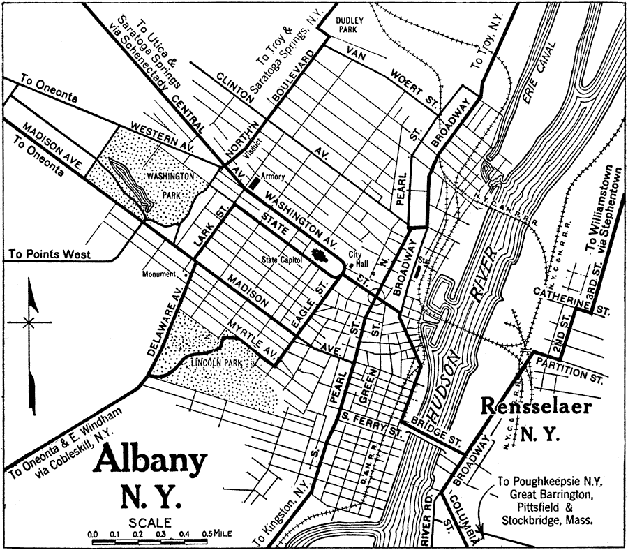
Description: A road map of Albany, New York, from the 1920 Automobile Club of Rochester, showing the Hudson River, principal roads, railroads and stations, parks, and major landmarks.
Place Names: New York, Albany, �Rensselaer, �Hudson River, �Erie Canal, �Lincoln Park, �Washington Park,
ISO Topic Categories: location,
inlandWaters,
structure,
transportation
Keywords: Albany and Rensselaer, physical, �transportation, kAutomobile, physical features, roads,
railroads, location,
inlandWaters,
structure,
transportation, Unknown,1920
Source: , Automobile Club of Rochester (New York, NY: The Automobile Club of Rochester, 1920) 386
Map Credit: Courtesy the private collection of Roy Winkelman |
|