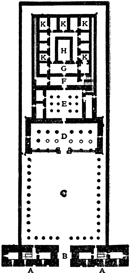
Description: This is a plan of the Temple of Edfu in Egypt. This is an example of Egyptian–style architecture. The key shows the architectural features of the Pylon (A), entrance door (B), Great Court (C), Hall of Columns (D), Second Hall (E), Hall of the Altar (F), Hall of the Centre (G), Sanctuary (H), and storerooms (K).
Place Names: Egypt, Plan of the Temple of Edfu, �Egyptian architecture,
ISO Topic Categories: structure
Keywords: Plan of the Temple of Edfu, historical, �archtecture, kArchitecture, structure, Unknown, 2134–1999 BC
Source: , The Enctclopædia Britannica a Dictionary of Arts, Sciences, Literature and General Information Eleventh Edition Volume II Andros to Austria (New York, NY: The Encyclopædia Britannica Company, 1910) 373
Map Credit: Courtesy the private collection of Roy Winkelman |
|