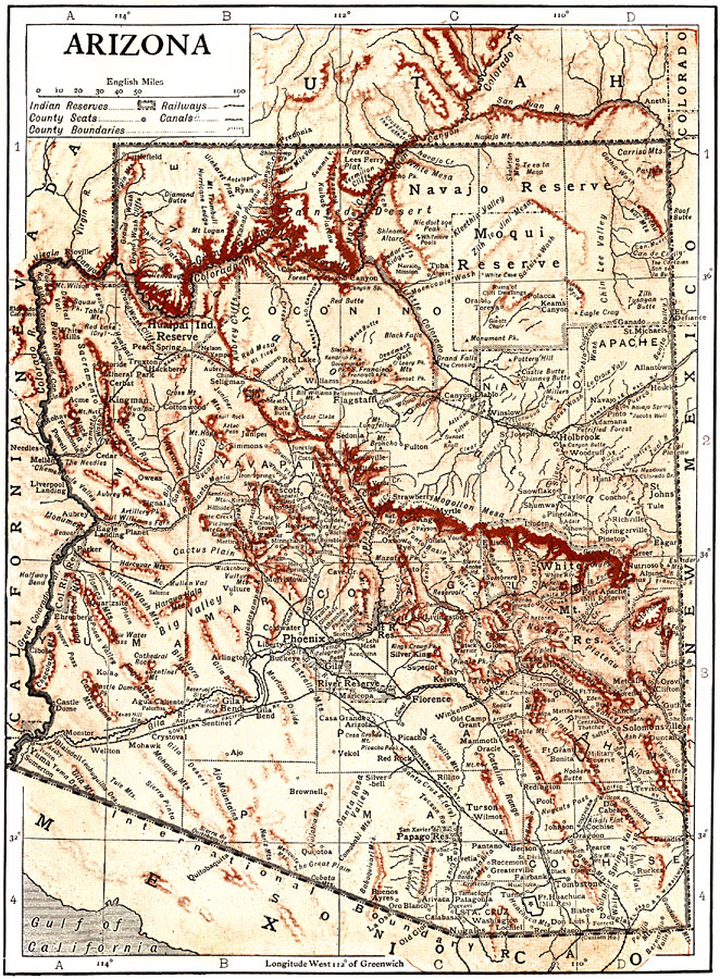
Description: A map of Arizona from 1910. The key shows Indian reserves, railways, county seats, canals, and county boundaries. "It is bounded N. by Utah, E. by New Mexico, S. by Mexico and W. by California and Nevada, the Colorado river separating it from California and in part from Nevada. On the W. side is the Great Basin. Arizona itself is mostly included in the great arid mountainous uplift of the Rocky Mountain region, and partly within the desert plain region of the Gulf of California, or Open Basin region. The whole state lies on the southwestern exposure of a great roof whose crest, along the continental divide in western New Mexico, pitches southward. Its altitudes vary from 12,800 ft. to less than 100 ft. above the sea."
Place Names: Arizona, Phoenix, �Prescott, �Tucson, �Navajo Reserve, �Moqui Reserve, �Apache Reserve, �Navajo Reserve, �Cochise, �Yavapai, �Haulpai Indian Reserve, �Yuma, �Coconino, �Painted Desert, �Black Canyon, �Colorado River, �Eagle Landing, �Kingman, �Flagstaff, �Litt
ISO Topic Categories: boundaries,
elevation,
inlandWaters,
transportation
Keywords: Arizona, physical, �political, �transportation, kNativeAmerican, physical features,
topographical, country borders,
major political subdivisions,
county borders, railroads,
roads,
water routes, boundaries,
elevation,
inlandWaters,
transportation, Unknown, 1910
Source: , The Enctclopædia Britannica a Dictionary of Arts, Sciences, Literature and General Information Eleventh Edition Volume II Andros to Austria (New York, NY: The Encyclopædia Britannica Company, 1910) 544
Map Credit: Courtesy the private collection of Roy Winkelman |
|