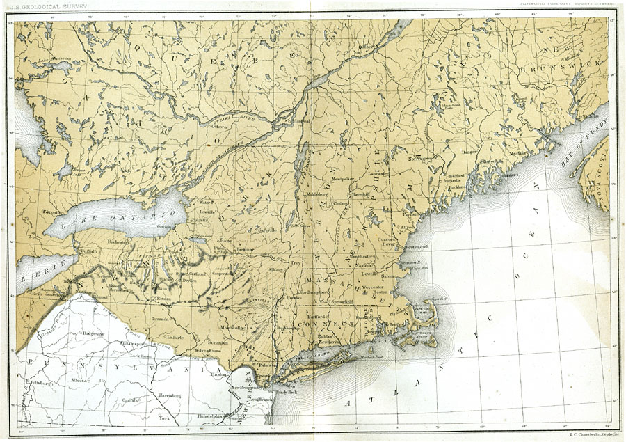
Description: A map showing the terminal moraine of the second glacial epoch east of the Great Lakes region, including the glacial landscape features of Cape Cod and Nantucket, Long Island, the Catskills and Finger Lakes, and the extreme terminal moraine described by Lewis and Wright which extends from approximately Salamanca, New York southeasterly to Easton, Pennsylvania, and across New Jersey to New Brunswick. Includes the drift bearing area, the generalized directions of glacial movement, the direction of glacial striae, and the locations of prominent terminal moraines. Map is referenced to Julius Bien and Co. lith.
Place Names: A Regional Map of North America, Canada, �United States, �Quebec, �Ontario, �New York, �Pennsylvania, �New Jersey, �Long Island, �Massachusetts, �Cape Cod, �Nantucket Sound,
ISO Topic Categories: geoscientificInformation,
inlandWaters,
oceans
Keywords: The Terminal Moraine (Eastern), physical, �political, kGeology, kGlacial, physical features, country borders,
major political subdivisions, geoscientificInformation,
inlandWaters,
oceans, Unknown, Second Glacial Epoch
Source: Thomas C. Chamberlin, United States Geological Survey Annual Report, 3rd (Washington, DC: United States Geological Survey, 1882) PL.XXXIII
Map Credit: Courtesy the private collection of Roy Winkelman |
|