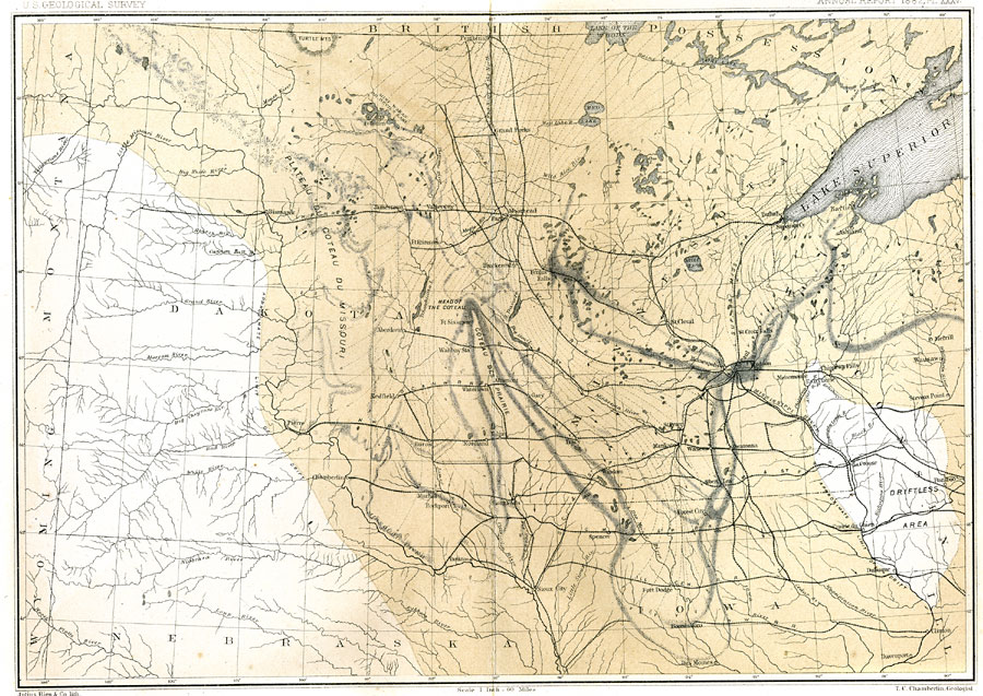
Description: The terminal moraine of the second glacial epoch west of the Great Lakes region, including the glacial landscape features of prairie pot-hole lakes, the Coteau des Prairie, and the driftless area near La Crosse, Wisconsin. The map includes the drift bearing area, the generalized directions of glacial movement, the direction of glacial striae, and the locations of prominent terminal moraines. Map scale is one inch equals 60 miles, and referenced to Julius Bien and Co. lith.
Place Names: Midwest States, Dakota, �Nebraska, �Iowa, �Minisota, �Wisconsin, �Mississippi River, �St. Paul, �Prairie du Chien, �Bismark, �Misourie River, �Sioux Falls, �Fargo,
ISO Topic Categories: boundaries,
geoscientificInformation,
inlandWaters
Keywords: The Terminal Moraine (Western) of the Second Glacial Epoch, physical, �political, �Plateau du Coteau du Missouri, �Coteau des Prairie, �Head of the Coteau, �transportation, kGlacial, physical features, country borders,
major political subdivisions, railroads, boundaries,
geoscientificInformation,
inlandWaters, Unknown, 1882
Source: Thomas C. Chamberlin, United States Geological Survey Annual Report, 3rd (Washington, DC: United States Geological Survey, 1882) PL.XXXV
Map Credit: Courtesy the private collection of Roy Winkelman |
|