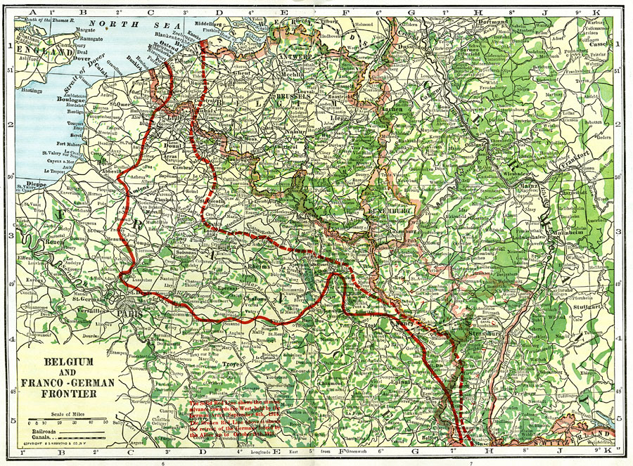
Description: A map of the Belgium and Franco-German frontier in 1918. "The Solid Red Line shows the utmost advance towards the West held by the German Army, September 6th, 1914. The Broken Red Line above it shows the retreat of the Germans forced by the Allies up to October 20th, 1918." (— The Victory Atlas of the War, 1918) The Alsace–Lorraine region is a mix of French and German culture. After World War I, the region gained independence for a short time. The Treaty of Versailles restored the region to French control. Germany had possession of it from 1940–1945 during World War II, but the territory was again returned to France where it has remained.
Place Names: Western Europe, France, �Germany, �Belgium, �Paris, �Luxemburg, �Alsace,�Lorraine,�Alsace-Lorraine, �Strassburg,�Brussels,
ISO Topic Categories: boundaries,
society
Keywords: Belgium and Franco-German Frontier, physical, �political, �transportation, �historical, �frontiers, kWWI, physical features, country borders, railroads,
water routes, WWI, boundaries,
society, Unknown, September 6th, 1914 and October 20th, 1918
Source: , The Victory Atlas of the War (New York, NY: Charles Scribner's Sons, 1918) 6-7
Map Credit: Courtesy the private collection of Roy Winkelman |
|