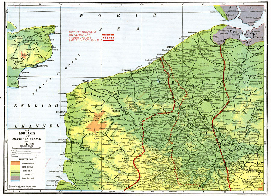
Description: A map of the lowlands of Northern France and Belgium during WWI. This map shows the French–German front movement in 1918. The dashed red line shows the furthest advance of the German Army. The red line with crosses is the Hindenburg line, a system of defenses built by the Germans along the Western Front. The solid thick red line is the battle line on Oct. 20th, 1918. This map shows cities, railroads, canals, rivers, and elevations.
Place Names: Western Europe, France, �United Kingdom, �Belgium, �Netherlands, �Lille, �Bruges, �Ghent,
ISO Topic Categories: boundaries,
elevation,
inlandWaters,
society
Keywords: Lowlands of Northern France and Belgium, physical, �political, �transportation, �historical, �forts, �fortresses, �battle lines, kWWI, physical features, country borders, railroads,
water routes, WWI, boundaries,
elevation,
inlandWaters,
society, Unknown, October 20, 1918
Source: , The Victory Atlas of the War (New York, NY: Charles Scribner's Sons, 1918) 9
Map Credit: Courtesy the private collection of Roy Winkelman |
|