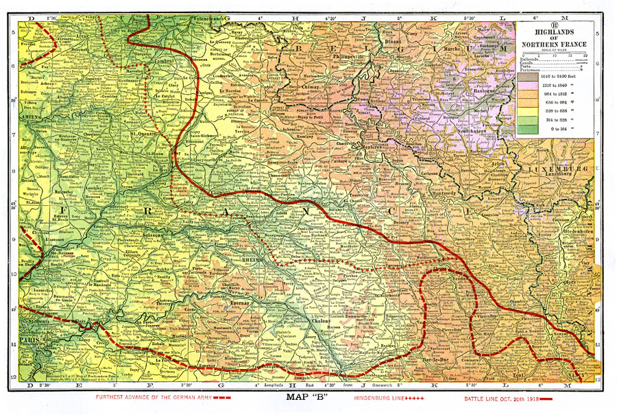
Description: A map of the French–German front movement during World War I in the highlands of northern France. The dashed red line shows the furthest advance of the German Army. The red line with crosses is the Hindenburg line, a system of defenses built by the Germans. The solid thick red line is the battle line on Oct. 20th, 1918. This map is color–coded to show elevations from sea level to 2400 feet, and shows major cities, railroads, rivers, and landforms.
Place Names: France, France, �Germany, �Belgium, �Paris, �Luxemburg,
ISO Topic Categories: boundaries,
elevation,
inlandWaters,
society
Keywords: Highlands of Northern France during WWI, physical, �political, �transportation, �historical, �forts, �fortresses, �battle lines, kWWI, physical features, country borders, railroads,
water routes, WWI, boundaries,
elevation,
inlandWaters,
society, Unknown, October 20, 1918
Source: , The Victory Atlas of the War (New York, NY: Charles Scribner's Sons, 1918) 10
Map Credit: Courtesy the private collection of Roy Winkelman |
|