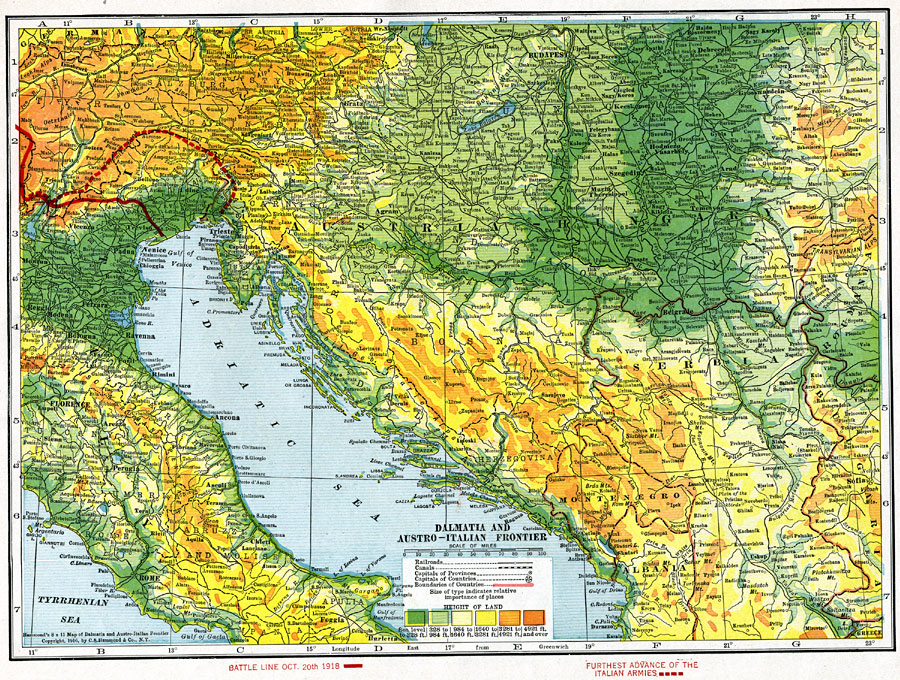
Description: Dalmatia, which is now part of Croatia, was part of the Austro–Hungarian Empire at the start of World War I. Dalmatia was occupied by Italy for a short time during World War I. The solid red line is the battle line on Oct. 20th, 1918. The dotted red line is the furthest advance of the Italian armies. The map is color–coded to show land elevations, and shows major cities and railways.
Place Names: Southeastern Europe, Italy, �Austria, �Hungary, �Austria-Hungary, �Serbia, �Montenegro, �Albania, �Bosnia, �Hertzegovina, �Adriatic Sea,
ISO Topic Categories: boundaries,
elevation,
inlandWaters,
society
Keywords: Dalmatia and Austro-Italian Frontier, physical, �political, �transportation, �historical, �fronts, �battle lines, kWWI, physical features, country borders, railroads,
water routes, WWI, boundaries,
elevation,
inlandWaters,
society, Unknown, October 20, 1918
Source: , The Victory Atlas of the War (New York, NY: Charles Scribner's Sons, 1918) 13
Map Credit: Courtesy the private collection of Roy Winkelman |
|