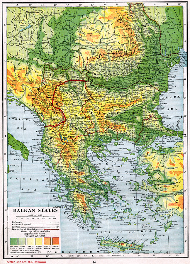
Description: A map of the Balkan States during World War I. World War I started in the Balkans, when Archduke Franz Ferdinand of Austria was assassinated in Sarajevo, Bosnia in 1914. The solid red line is the battle line on Oct. 20th, 1918. The map is color–coded to show land elevations, and shows major cities and railways.
Place Names: Southeastern Europe, Romania, �Greece, �Austria, �Hungary, �Austria-Hungary, �Croatia, �Roumania, �Romania, �Bulgaria, �Turkey, �Serbia, �Albania, �Montenegro, �Bosnia, �Hertzegovina,
ISO Topic Categories: boundaries,
elevation,
inlandWaters
Keywords: Balkan States, physical, �political, �transportation, �historical, �battle lines, �physical features, country borders, railroads,
water routes, WWI, boundaries,
elevation,
inlandWaters, Unknown, October 20, 1918
Source: , The Victory Atlas of the War (New York, NY: Charles Scribner's Sons, 1918) 14
Map Credit: Courtesy the private collection of Roy Winkelman |
|