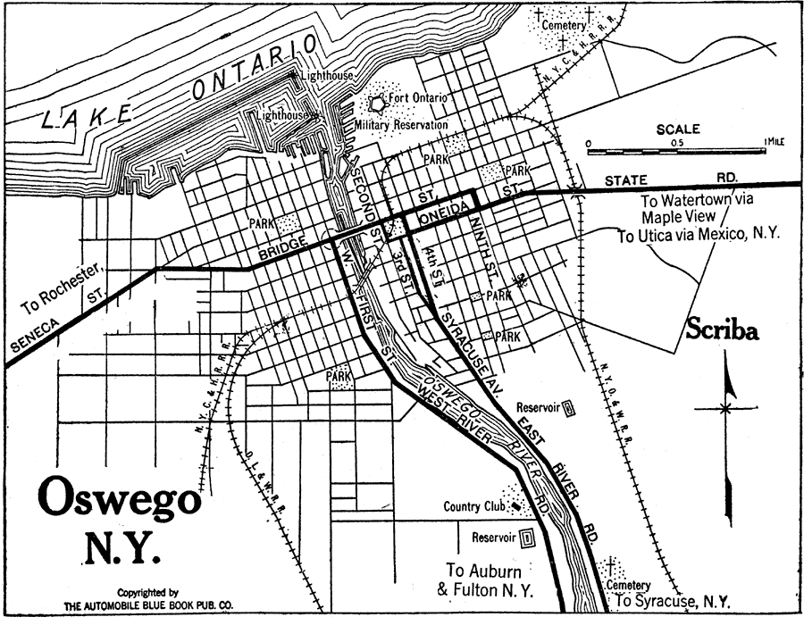
Description: A road map of Oswego, New York, from the 1920 Automobile Club of Rochester, showing the Oswego River and Lake Ontario, principal roads, railroads and stations, light houses, fort, parks, cemeteries, and major landmarks.
Place Names: New York, Oswego, �Lake Ontario, �Oswego River, �Fort Ontario, �Scriba,
ISO Topic Categories: structure,
location,
inlandWaters,
intelligenceMilitary,
transportation
Keywords: Oswego, New York, physical, �transportation, kAutomobile, physical features, roads,
railroads, structure,
location,
inlandWaters,
intelligenceMilitary,
transportation, Unknown,1920
Source: , Automobile Club of Rochester (New York, NY: The Automobile Club of Rochester, 1920) 560
Map Credit: Courtesy the private collection of Roy Winkelman |
|