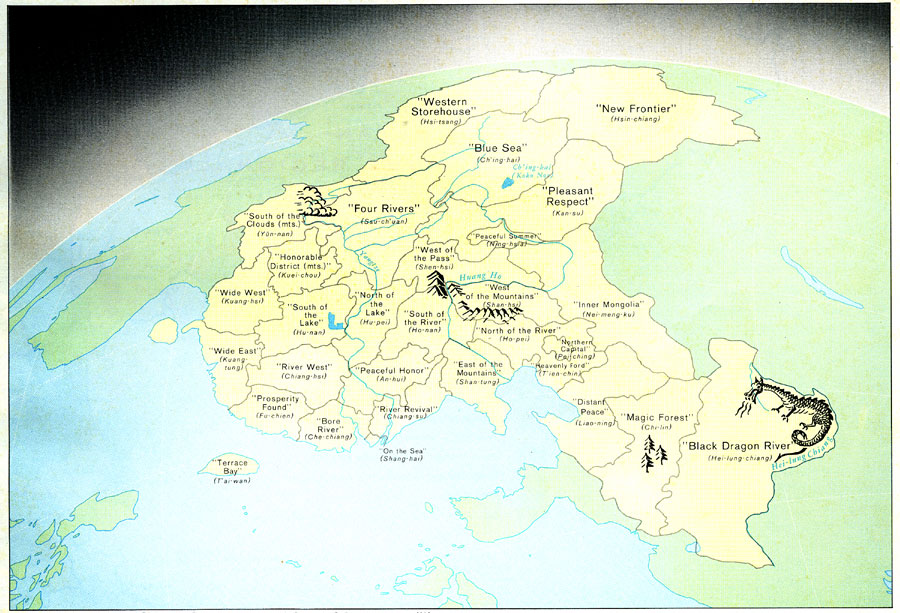
Description: " Chinese place names may take on picturesque qualities when rendered in literal translation. This view of China from the east suggests the geographic origins of many of the ancient province names. Geographic features frequently comprising elements of place names include: pei – north, nan – south, tung – east, hsi – west, ho and chiang – river, hu – lake, and shan – mountain. " — CIA, 1971
Place Names: China, Sinkaing, �Tibet, �Tsinghai, �Szechwan, �Kansu, �Yunnan, �Kweichow, �Kwangsi, �Hunan, �Shensi, �Shansi, �Fukein, �Heilungkian
ISO Topic Categories: society
Keywords: China's Province Names, political, �physical, major political subdivisions, society, Unknown, 1971
Source: Central Intelligence Agency, People's Republic of China Atlas (Washington, DC: U.S. Government Printing Office, 1971) 33
Map Credit: Courtesy the private collection of Roy Winkelman |
|