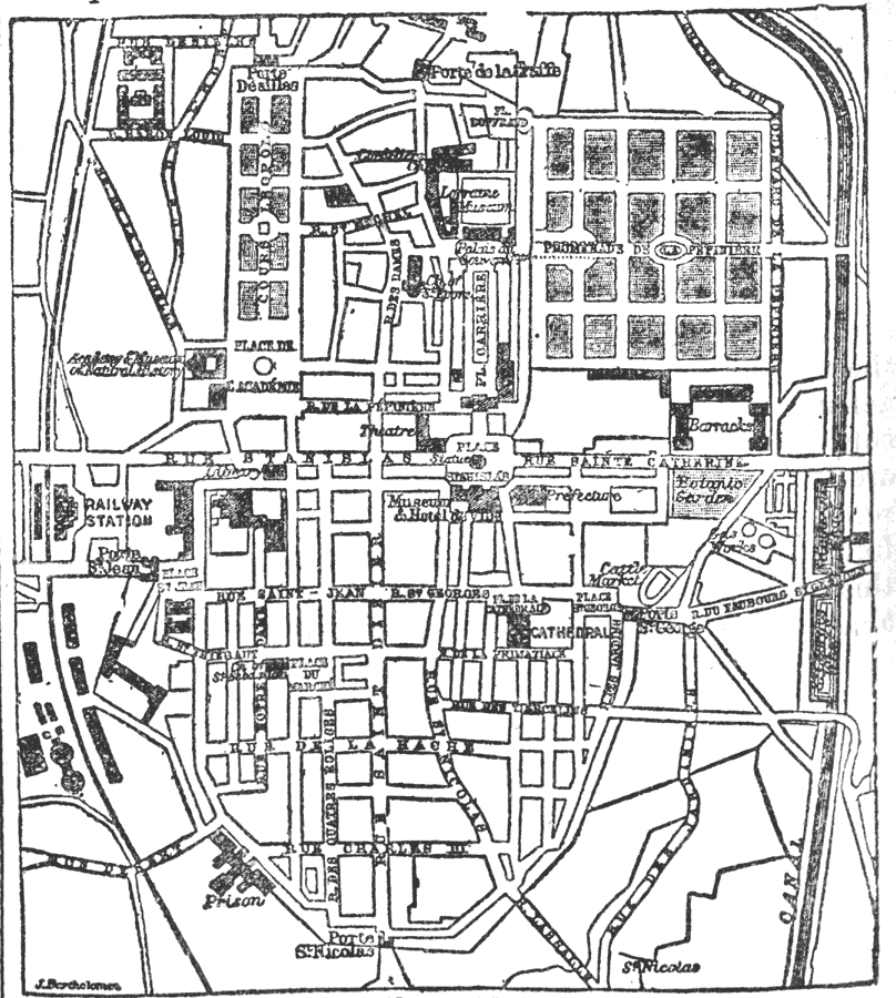
Description: A map of "Nancy, the ancient capital of Lorraine, afterwards the chief town of the French department of Meurthe, and since 1872 that of the department of Meurthe–et–Moselle." —Kellogg, 1903This map shows the location of roads, a railroad, a canal, and several important features. The features indicated on the map include: the prison, the barracks, the cattle market, the botanic gardens, a railway station, a cathedral, and several other features in Nancy.
Place Names: France, Nancy, �Lorraine, �Meurthe, �Meurthe-et-Mosell
ISO Topic Categories: transportation,
structure,
inlandWaters
Keywords: Plan of Nancy, physical, �transportation, �barracks, �prison, �parks, �church, physical features, roads,
railroads,
water routes, transportation,
structure,
inlandWaters, Unknown, 1903
Source: Day Otis Kellogg, Encyclopædia Britannica Vol. XVII (New York, NY: Werner Company, 1903) 170
Map Credit: Courtesy the private collection of Roy Winkelman |
|