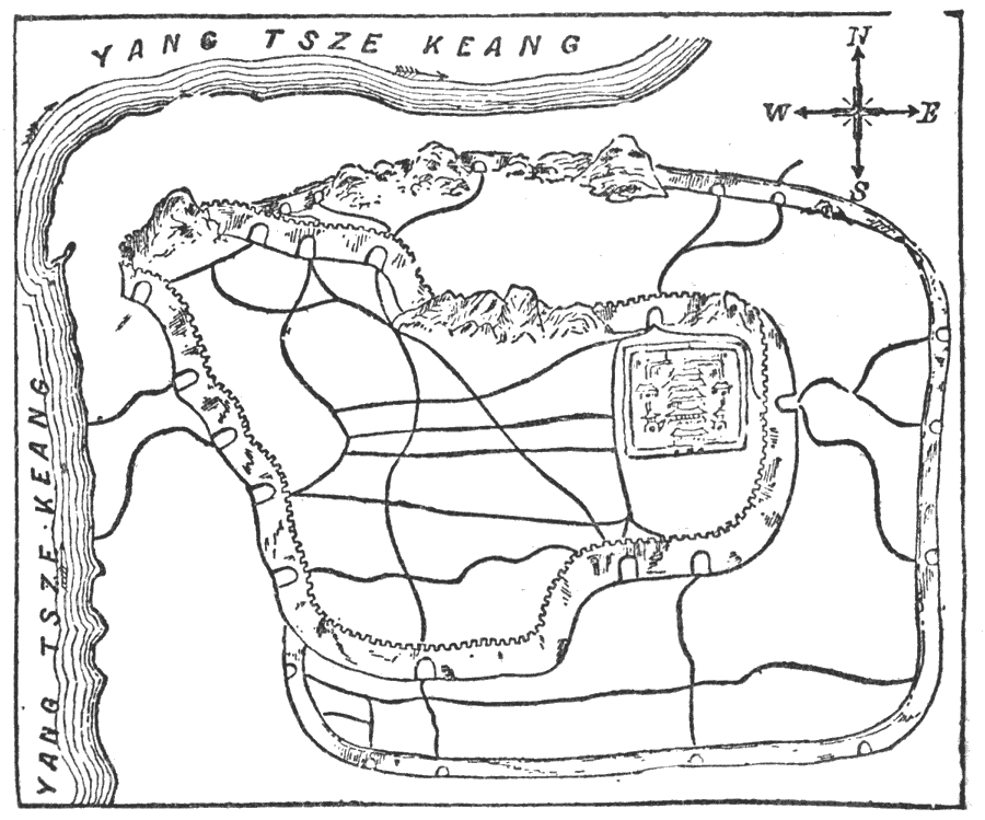
Description: A pictorial city plan of Nanking (Nanjing), China, from 1903, showing Yang Tsze Keang (Yangtze River), the walls of the city, and various roads. Today it is known as Nanjing, but this city has had many names throughout its history. "Nanking, or ‘the southern capital,’ is the name by which Keang–ning, the chief city in the province of Keang–soo, in China, has been popularly known for several centuries. The present city, which stands in 32° 5’ N. lat. and 118° 47’ E. long., dates only from the beginning of the Ming dynasty (1368), although it is built on the site of one which for more than two thousand years has figured under various names in the history of the empire. The more ancient city was originally known as Kin–ling; under the Han dynasty (206 B.C. to 25 A.D.) its name was converted into Tan–yang; by the T’ang emperors (618-907 A.D.) it was styled Keang–nan and Shing Chow; by the first sovereign of the Ming dynasty (1368-1644) it was created the ‘southern capital’ (Nan-king), and was given the distinctive name of Ying-t’een; and since the accession to power of the present Manchu rulers it has been officially known as Keang–ning, though still popularly called Nan–king. As a matter of fact it was the seat of the imperial court only during the reigns of the first two emperors of the Ming dynasty, and was deserted for Shunt’een (Peking) by Yung–lo, the third sovereign of that line, who in 1403 captured the town and usurped the crown of his nephew, the reigning emperor. But even when speaking of the city rebuilt by the Ming emperors it is necessary to use the past tense. The Taiping rebels, who carried the town by assault in 1853, made a clean sweep of all the national monuments and most of the more conspicuous public buildings it contained, and destroyed or were the means of destroying the greater part of the magnificent wall which surrounded it."Kellogg, 1903.
Place Names: China, Nanjing, �Nanking, �Jiangsu, �Keangsoo, �Keang-ning, �Tan-yang, �Kin-ling, �Yang Tsze Keang, �Yangtze River, �Keang-nan, �Shing Chow, �Ying-t'een, �Nan-kin
ISO Topic Categories: structure,
inlandWaters,
transportation
Keywords: Plan of Nanking, physical, �transportation, �wall, �walls, physical features, roads, structure,
inlandWaters,
transportation, Unknown, 1903
Source: Day Otis Kellogg, Encyclopædia Britannica Vol. XVII (New York, NY: Werner Company, 1903) 171
Map Credit: Courtesy the private collection of Roy Winkelman |
|