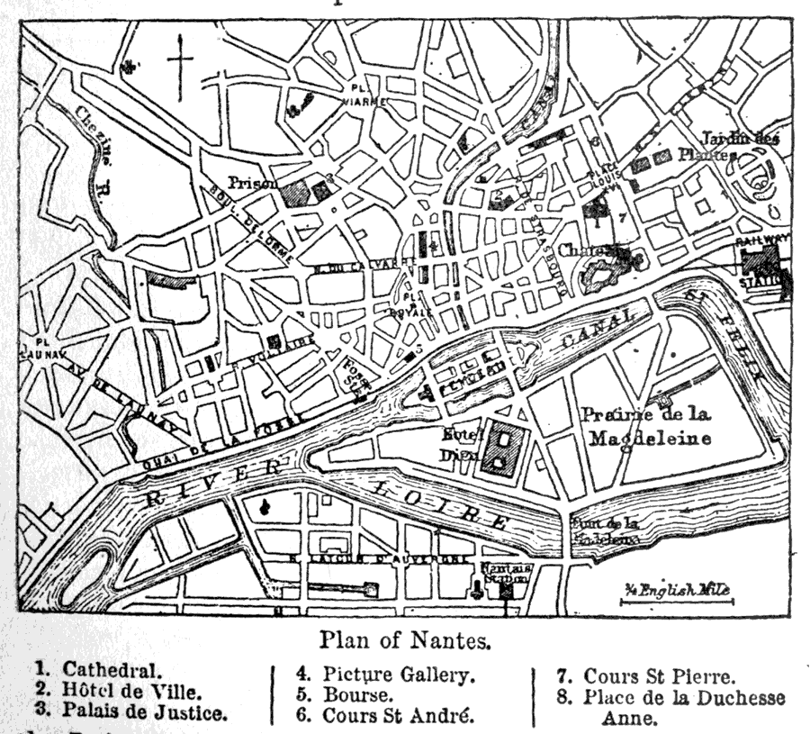
Description: A map of the city of Nantes, France showing the River Loire, the Canal St. Felix, the prison, the railway station, the Prairie de la Magdeleine, roads, and various other features. Some features are indicated on the map by number including: (1) Cathedral, (2) Hotel de Ville, (3) Palais de Justice, (4) Picture Gallery, (5) Bourse, (6) Cours St. André, (7) Cours St. Pierre, and (8) Place de la Duchesse Anne.
Place Names: France, Nantes, �River Loire, �Canal St. Feli
ISO Topic Categories: inlandWaters,
transportation,
structure
Keywords: Plan of Nantes, physical, �transportation, physical features, railroads,
water routes, inlandWaters,
transportation,
structure, Unknown, 1903
Source: Day Otis Kellogg, Encyclopædia Britannica Vol. XVII (New York, NY: Werner Company, 1903) 173
Map Credit: Courtesy the private collection of Roy Winkelman |
|