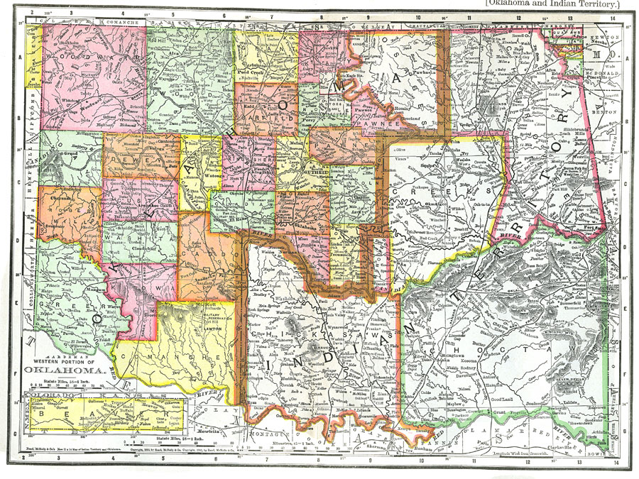
Description: A map from 1903 of the Indian Territory and Oklahoma Territory prior to statehood (November 16, 1907), showing the boundary between the territories, the territorial capitals of Tahlequah (Indian Territory) and Guthrie (Oklahoma Territory), counties and tribe lands, principal cities and towns, railroads, mountains, and rivers.
Place Names: Oklahoma, Lawton, �Oklahoma City, �Indian Territory, �Shawnee Hills, �Seven Devils, �Antelope Hills, �Red Rive
ISO Topic Categories: boundaries,
transportation,
inlandWaters
Keywords: Oklahoma and Indian Territory, physical, �political, �transportation, kNativeAmerican, physical features,
topographical, major political subdivisions,
county borders, railroads, boundaries,
transportation,
inlandWaters, Unknown,1903
Source: Day Otis Kellogg, Encyclopædia Britannica Vol. XVII (New York, NY: Werner Company, 1903) 748
Map Credit: Courtesy the private collection of Roy Winkelman |
|