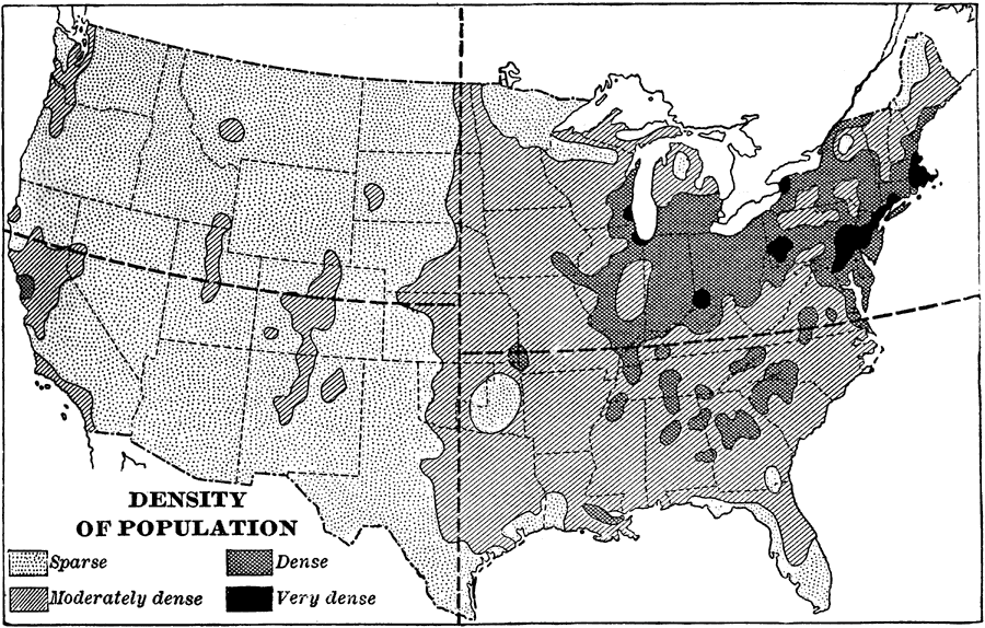
Description: A map from 1898 showing the density of population in the contiguous 48 states at the time. The map is coded to show areas of density ranging from sparsely populated to areas of dense population. "The eastern half of the United States contains nearly nine tenths of the people in the country." &mdashRedway, 1898.
Place Names: Demographics, populatio
ISO Topic Categories: society
Keywords: Density of Population, statistical, �historical, kPopulation, population, society, Unknown,1898
Source: Jacques W. Redway and Russell Hinman, Natural Advanced Geography (New York, NY: American Book Company , 1898) 57
Map Credit: Courtesy the private collection of Roy Winkelman |
|