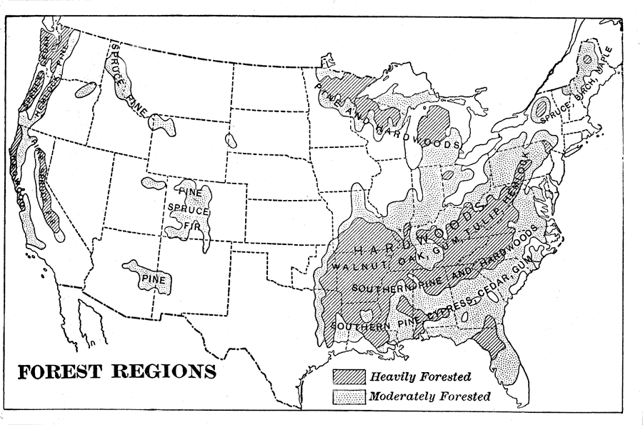
Description: A map from 1898 of the United States showing the forest regions in the contiguous 48 states. "Fully one third of the timber cut in the world each year comes from the forests of the United States. Indeed, lumbering is carried on so extensively and recklessly in this country that in a few years our best forests will be destroyed unless cutting is more carefully regulated. Lumber, in the shape of logs, beams, boards, and shingles, forms one of our important exports." &mdashRedway, 1898.
Place Names: Forestry,
ISO Topic Categories: biota,
economy
Keywords: Forest Regions, statistical, �historical, kResources, vegetation,
economic, biota,
economy, Unknown,1898
Source: Jacques W. Redway and Russell Hinman, Natural Advanced Geography (New York, NY: American Book Company , 1898) 59
Map Credit: Courtesy the private collection of Roy Winkelman |
|