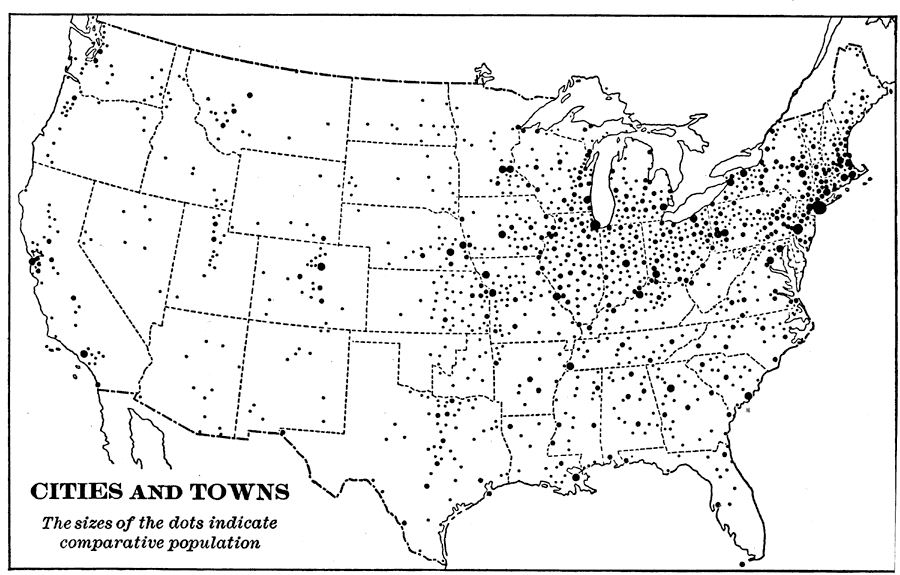
Description: A map from 1898 of the contiguous 48 states showing the distribution pattern of the major cities and towns at the time. The size of the dots indicate comparative populations. "Most of the manufacturing of the world is carried on in cities and towns. On this map the cities and towns of the United States are shown by dots, the larger dots standing for the larger manufacturing centers. About nine tenths of our manufacturing is done in that [the northeastern] quarter of the country." — Redway, 1898.
Place Names: A Complete Map of the United States,
ISO Topic Categories: boundaries,
society
Keywords: Cities and Towns of the United States, statistical, �political, �historical, kPopulation, major political subdivisions,
country borders, population, boundaries,
society, Unknown,1898
Source: Jacques W. Redway and Russell Hinman, Natural Advanced Geography (New York, NY: American Book Company , 1898) 59
Map Credit: Courtesy the private collection of Roy Winkelman |
|