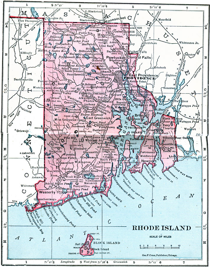
Description: A map from 1906 of Rhode Island showing the capital at Providence, principal cities and towns, railroads, lakes, rivers, and coastal features.
Place Names: Rhode Island, Bristol, �Greenwich, �Kingston, �Narragansett Pier, �Newport, �Pawtucket, �Providence, �Warren, �Warwick, �Woonsocke
ISO Topic Categories: boundaries,
inlandWaters,
location,
oceans
Keywords: Rhode Island, physical, �political, �borders, �boundaries, �physical features, country borders, boundaries,
inlandWaters,
location,
oceans, Unknown, 1906
Source: George F. Cram , Cram's Quick Reference Atlas and Gazetteer of the World (Chicago , IL: George F. Cram Series of Atlases, 1906) 14
Map Credit: Courtesy the private collection of Roy Winkelman |
|