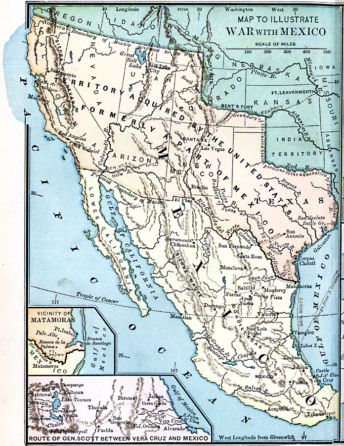
Description: A map of Mexico and southern United States showing the campaigns and battle sites of the Mexican–American War (1846–1848). The map shows the routes of Taylor, Wool, Kearny, Doniphan, and Scott, the pre–war boundaries of the United States and Mexico, and the disputed territory claimed by Mexico and Texas. Inset maps detail the area near the mouth of the Rio Grande River and vicinity of Matamoras where the opening battles took place at Palo Alto and Resaca de la Palma, and a map of Scott's march from Veracruz to the City of Mexico (1847–1848).
Place Names: A Regional Map of North America, Mexico, �United State
ISO Topic Categories: location,
oceans,
inlandWaters,
boundaries,
intelligenceMilitary
Keywords: War with Mexico, physical, �political, �historical, �mexican war, physical features, country borders,
major political subdivisions, other military, location,
oceans,
inlandWaters,
boundaries,
intelligenceMilitary, Unknown, 1846–1848
Source: Joel Dorman Steele, A Brief History of the United States (New York, NY: American Book Company, 1885) 148
Map Credit: Courtesy the private collection of Roy Winkelman |
|