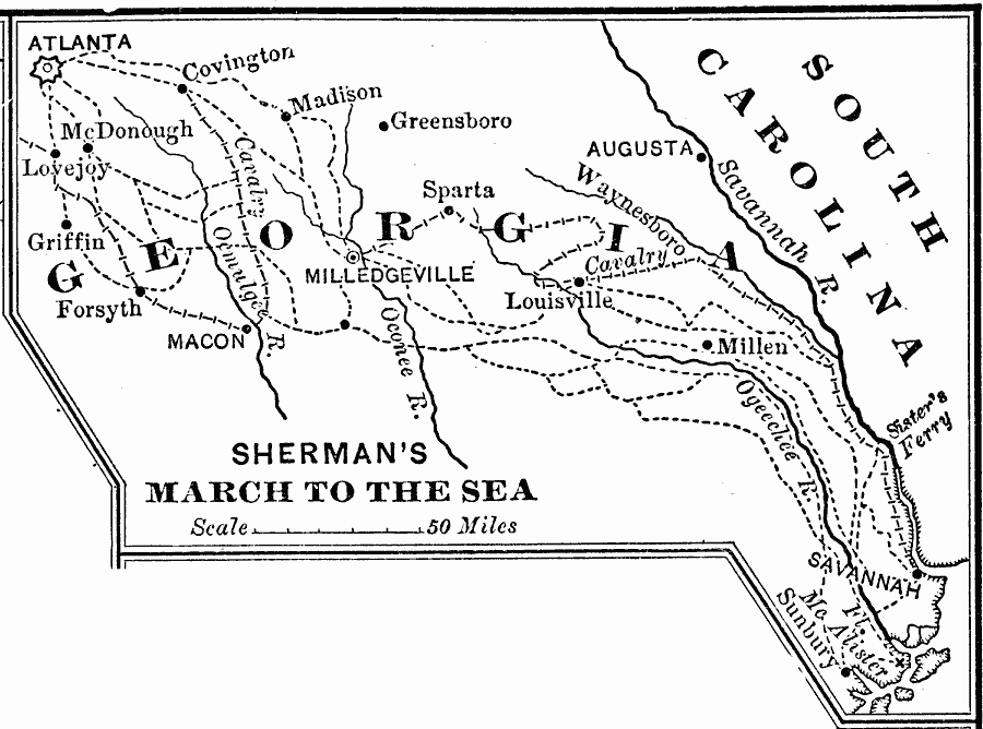
Description: A map showing the route of General Sherman's Savannah Campaign or "March to the Sea" (1864) during the American Civil War. The map is keyed to show the campaign routes, railroads, and battle sites.
Place Names: Georgia, Atlanta, �Savannah, �Griffen, �Macon, �Sparta, �August
ISO Topic Categories: intelligenceMilitary,
inlandWaters,
location,
boundaries
Keywords: Sherman's March to the Sea, historical, �physical, �political, physical features, major political subdivisions, Civil War, intelligenceMilitary,
inlandWaters,
location,
boundaries, Unknown, 1864
Source: Joel Dorman Steele, A Brief History of the United States (New York, NY: American Book Company, 1885) 222
Map Credit: Courtesy the private collection of Roy Winkelman |
|