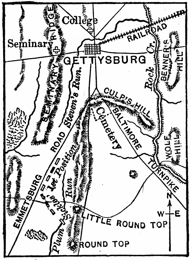
Description: A map of the vicinity of Gettysburg during the Civil War. The map shows roads and railroads, Steven's Run and Rock Creek, and the terrain features of Seminary Ridge, Benner's Hill, Culp's Hill, Wolf Hill, Little Round Top, and Round Top.
Place Names: Pennsylvania, Gettysbur
ISO Topic Categories: boundaries,
inlandWaters,
intelligenceMilitary,
location
Keywords: Vicinity of Gettysburg, political, �physical, �historical, �transportation, kBattle, physical features, local jurisdictions, roads,
railroads, Civil War, boundaries,
inlandWaters,
intelligenceMilitary,
location, Unknown, July 1–3, 1863
Source: Joel Dorman Steele, A Brief History of the United States (New York, NY: American Book Company, 1885) 252
Map Credit: Courtesy the private collection of Roy Winkelman |
|