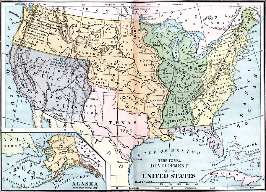
Description: A map of the United States showing the growth of the nation from 1783–1867. The map is color–coded to show the thirteen original states, the territory acquired by conquest during the revolution and the Treaty of 1783, the Louisiana Territory purchased from France in 1803, the Florida territory ceded by Spain in 1819, the Texas Territory annexed in 1845, the Oregon Country acquired by the treaty with Great Britain in 1846, the Mexican cession of western territories in 1848, the Gadsden Purchase in northern Mexico in 1853, and the purchase of Alaska from Russia in 1867. The map shows the boundaries and capitals of the states and territories at the close of 1867, with the dates for state admission into the Union given. An inset map details the territory of Alaska.
Place Names: Growth of Nation, Washington D.C., �San Francisco, �San Diego, �Salt Lake City, �New York, �Boston, �Galveston, �Chicago, �New Orlean
ISO Topic Categories: boundaries,
location,
oceans,
inlandWaters
Keywords: Territorial Development of the United States, physical, �political, physical features, country borders,
major political subdivisions, boundaries,
location,
oceans,
inlandWaters, Unknown, 1783–1867
Source: Joel Dorman Steele, A Brief History of the United States (New York, NY: American Book Company, 1885) 280
Map Credit: Courtesy the private collection of Roy Winkelman |
|