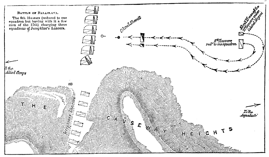
Description: A map of the battlefield at Balaclava. The Battle of Balaclava was fought between Russian forces and the allied forces of the United Kingdom, France, and the Ottoman Empire on 25 October, 1854. This map shows the charge of the 8th Hussars under Colonel Sherwell, part of the event immortalized by Lord Tennyson (Charge of the Light Brigade). "The 8th Hussars (reduced to one squadron but having with it a few men of the 17th) charging three squadrons of Jeropkine's Lancers." —Collier
Place Names: Ukraine, England, �Balaclav
ISO Topic Categories: society
Keywords: Battle of Balaclava, physical, �historical, kBattle, topographical, society, Unknown,October 25, 1854
Source: Nugent Robinson, History of the World Vol. II (New York, NY: P. F. Collier, ) 932
Map Credit: Courtesy the private collection of Roy Winkelman |
|