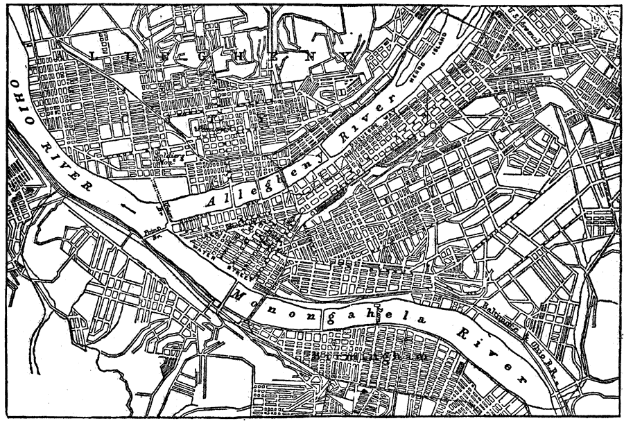
Description: A plan of Pittsburgh from 1903 showing principal streets, railroads and stations, bridges, and landmarks. "Pittsburgh, the second largest city of Pennsylvania, and the leading iron, steel, and glass manufacturing center of the United States, lies at the confluence of the Allegheny and the Monongahela, which unite here to form the Ohio, 250 miles west by north of Philadelphia. The business quarter of the city is built on a nearly level triangular plain, between the two rivers, measuring about three quarters of a mile on each side back to the hills which rise to the east." — Kellogg, 1903.
Place Names: Pennsylvania, Pittsburg, �Pittsburgh, �Ohio River, �Allegheny River, �Monongahela Rive
ISO Topic Categories: boundaries,
inlandWaters
Keywords: Plan of Pittsburgh, physical, �political, physical features, local jurisdictions, boundaries,
inlandWaters, Unknown,1903
Source: Day Otis Kellogg, D.D., Encyclopedia Britannica Vol. XIX (New York, NY: The Werner Company, 1903) 150
Map Credit: Courtesy the private collection of Roy Winkelman |
|