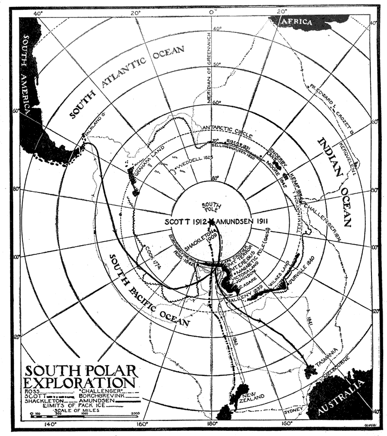
Description: A map from 1921 showing Antarctica and the routes of exploration, including the route of Ross (1839-1843), the H.M.S. Challenger (1872-1876), Borchgrevink (1898-1900), Shackleton (1909), Amundsen (1911), and Scott (1912). " South Polar Exploration. Previous to the latter half of the nineteenth century comparatively little attention was given to exploration in the Antarctic regions. The first navigator known to have crossed the Antarctic Circle was Captain James Cook, who in 1773-74 explored a portion of the land mass surrounding the South Pole. Later explorations confirmed Cook's discovery, and existence of the continent of Antarctica is now undisputed. While the shoreline of this great land mass has not been fully surveyed, it is estimated to have an area of over 5,000,000 square miles, making it about twice the size of Australia. It has an average elevation of 2,000 feet and mountains exceeding 15,000 feet in altitude. Different sections of this continent have been discovered by various explorers, each believing that he had found a separate land mass, and giving it a distinct name, so we find on the south polar maps Wilkes Land, South Victoria Land, King Edward VII Land, etc., all probably belonging to one great land mass. " — Foster, 1921.
Place Names: Antarctic Region, Wilkes Land, �Enderby Land, �Cape Crozier, �Victoria Land, �Graham Lan
ISO Topic Categories: society
Keywords: South Polar Exploration, physical, �historical, �exploration, �explorers, physical features, historical event, society, Unknown,1921
Source: Ellsworth D. Foster, ed., The American Educator Vol. 7 (Chicago, IL: Ralph Durham Company, 1921) 3367
Map Credit: Courtesy the private collection of Roy Winkelman |
|