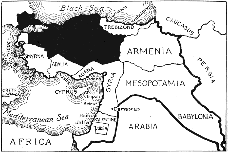
Description: This is a map of Turkey during the Ottoman Empire occupation post 1914. "The black area in Asia represents the only territory left under the undisputed sway of the sultan; the black area in Europe may be separated entirely from the realm of Turkey; that question is to be determined by the league of nations. The heavy boundary line marks the limits of the empire in 1914." — Foster, 1921
Place Names: Regional Mediterranean, Asia, �Europe, �Africa, �Turkey, �Anatolia, �Smyrna, �Adalia, �Adana, �Syria, �Palestine, �Trebizond, �Caucasus, �Persia, �Armenia, �Mesopotamia, �Babylonia, �Persia, �Arabia, �Judea, �Cyprus, �Crete, �Dodecanesus, �Black Sea,�Mediterranean Sea, �Gre
ISO Topic Categories: political, kWorldAfroAsia
Keywords: Turkey of the Future, political, country borders,
major political subdivisions, political, kWorldAfroAsia, Unknown,1914
Source: Ellsworth D. Foster ed., The American Educator Vol. 8 (Chicago, IL: Ralph Durham Company, 1921) 3650
Map Credit: Courtesy the private collection of Roy Winkelman |
|