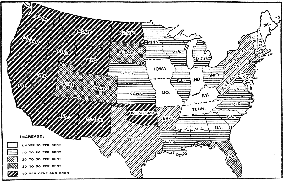
Description: A map of the United States showing the increase in population per state between the 1900 and 1910 census. The map is keyed to show State population increases ranging from under 2 per cent to 50 per cent and over. "This is a map classifying states with respect to the percentage of increase of population between twelfth and thirteenth censuses. The greatest growth has been in the central and western states, where the increase has been unusually large. This is due to the fertility of the soil in the Mississippi Valley and the opportunities and advantages offered by a new country." — Foster, 1921.
Place Names: Demographics, Lake Superior, �Lake Huron, �Lake Erie, �Lake Ontario, �Lake Michigan�populatio
ISO Topic Categories: society
Keywords: United States Growth in Population by Decades, statistical, �population increase, �twelfth census, �thirteenth census, kPopulation, population, society, Unknown,1900–1910
Source: Ellsworth D. Foster, ed., The American Educator Vol. 8 (Chicago, IL: Ralph Durham Company, 1921) 3689
Map Credit: Courtesy the private collection of Roy Winkelman |
|