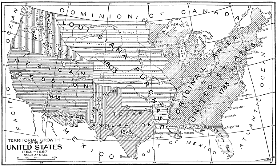
Description: The United States, showing the growth of territory from 1783 to 1867. This includes the large addition made by the Louisiana Purchase in 1803. It shows all of the major political boundaries of the time, including the United States, Spanish Cession, Mexican Cession, Texas Cession, Oregon Country by discovery exploration and treaty with Great Britain and the Northwest Territory. — Foster, 1921
Place Names: Growth of Nation, Boston, �New York, �Chicago, �New Orleans, �Washington D.C., �Pittsburg, �Philadelphia, �Lake Superior, �Lake Huron, �Lake Erie, �Lake Ontario, �Lake Michigan, �Mississippi River, �Missouri River, �Original Area of the United States 1783, �Spanish Cess
ISO Topic Categories: boundaries
Keywords: Territorial Growth of the United States 1783 to 1867, political, �territory, �territorial, �boundariescountry borders,
major political subdivisions, boundaries, Unknown,1783–1867
Source: Ellsworth D. Foster, ed., The American Educator Vol. 8 (Chicago, IL: Ralph Durham Company, 1921) 3698
Map Credit: Courtesy the private collection of Roy Winkelman |
|