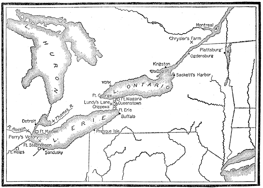
Description: A map of the Great Lakes region showing the main operations during the War of 1812 (1812–1814). It also shows some of the inland waters. This war was between the United States and Great Britain because of "Great Britain's attitude in relation to American shipping." — Foster, 1921.
Place Names: A Regional Map of North America, Canada, �United States, �Lake Huron, �Lake Ontario, �Lake Erie, �Detroit, �Montreal, �Plattsburg, �Ogdensburg, �Buffalo, �Sandusky, �Ft. Meig's, �Presque Isle, �Sackett's Harbor, �Chrysler's Farm, �Kingston, �York, �Ft. George, �Lundy's Lane, �Queensto
ISO Topic Categories: boundaries,
society
Keywords: War of 1812 Map of Main Operations, physical, �political, �historical, physical features, major political subdivisions, other military,
historical event, boundaries,
society, Unknown,1812
Source: Ellsworth D. Foster, ed., The American Educator Vol. 8 (Chicago, IL: Ralph Durham Company, 1921) 3805
Map Credit: Courtesy the private collection of Roy Winkelman |
|