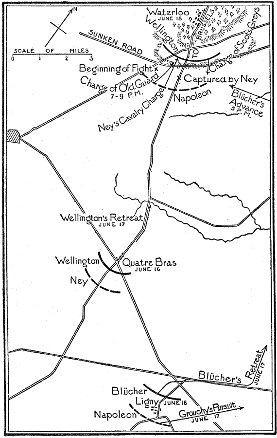
Description: This is a map showing the Battle of Waterloo. It was "near Waterloo, a village in Belgium about eleven miles south of Brussels, between Napoleon and the allied forces under Bliicher and Wellington. It was Napoleon's last battle, and it put an end to his power." — Foster, 1921 This map shows the battle from the preliminary battles on the 16th to the end on the 18th.
Place Names: Belgium, Brussels, �Waterloo, �Sunken Roa
ISO Topic Categories: boundaries,
society,
transportation
Keywords: Battle of Waterloo, physical, �political, �historical, kNapoleonBonaparte, kNapoleonicWars, physical features, major political subdivisions, other military,
historical event, boundaries,
society,
transportation, Unknown,June 18, 1815
Source: Ellsworth D. Foster ed., The American Educator Vol. 8 (Chicago, IL: Ralph Durham Company, 1921) 3827
Map Credit: Courtesy the private collection of Roy Winkelman |
|