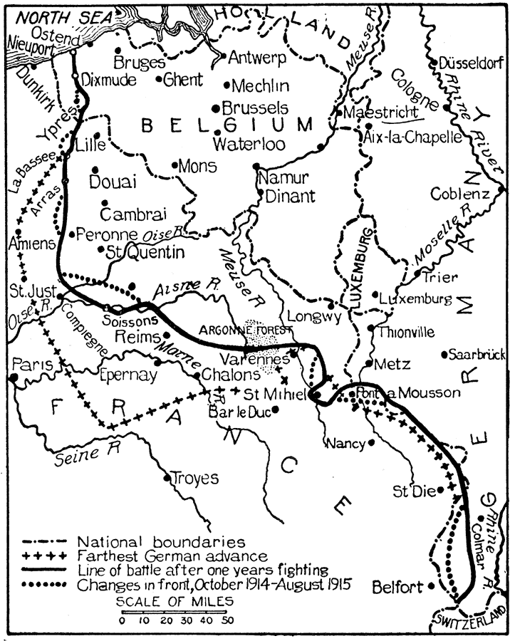
Description: This is a map showing the boundaries and battles in the western campaign of World War I from 1914 to 1915. "Immediately after the war broke out the German strategy became clear. A quick, decisive dash into France was to be followed by the shifting of most of the victorious troops from the west to meet the Russian millions on the east. This plan failed by only the narrowest of margins, partly because the Belgian resistance delayed the advance and gave the French time to organize, and partly because the Russians mobilized more rapidly than had been expected. When the campaign in France was at a crisis, therefore, the Germans were compelled to weaken their offensive by sending thousands of soldiers to defend their eastern frontier against strong forces of the czar. The western campaign developed with great rapidity. The Germans appeared before Liege on August 5, and took the city on the 8th. Before the end of August they had taken practically all of Belgium except Antwerp and a narrow strip on the coast." — Foster, 1921.
Place Names: Western Europe, France, �Germany, �Belgium, �Holland, �Antwerp, �Bruges, �Ghent, �Mechlin, �Brussels, �Dixmude, �Waterloo, �Maestricht, �Cologne, �Aix-la-Chapelle, �Dusseldorf, �Coblenz, �Rhine River, �Meuse River, �Ostend, �Newport, �Dunkirk, �LaBassee, �Troyes, �Par
ISO Topic Categories: boundaries,
society,
inlandWaters
Keywords: World War I: A Year of War in the West, physical, �political, �historical, kWWI, physical features, country borders,
major political subdivisions, WWI, boundaries,
society,
inlandWaters, Unknown,1914–1915
Source: Ellsworth D. Foster ed., The American Educator Vol. 8 (Chicago, IL: Ralph Durham Company, 1921) 3917
Map Credit: Courtesy the private collection of Roy Winkelman |
|