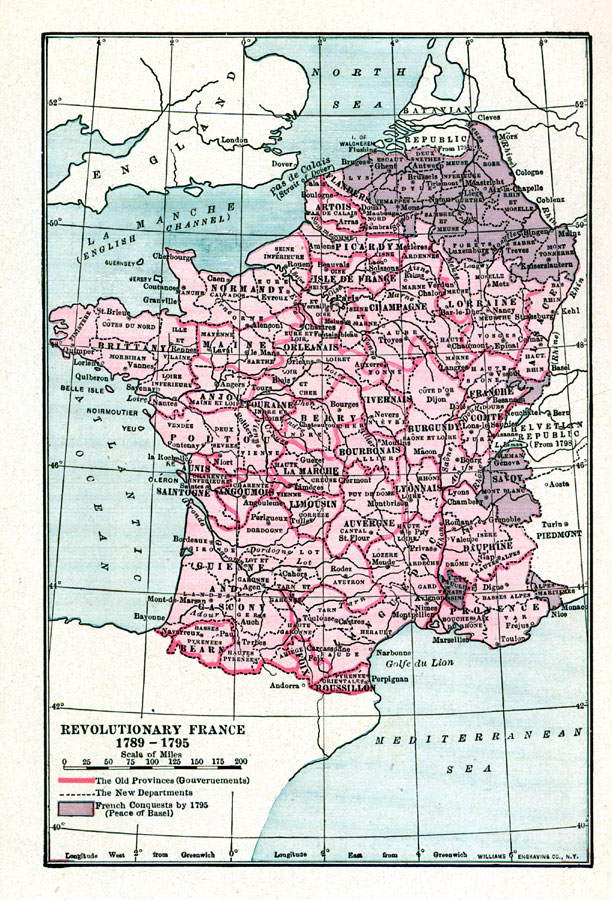
Description: A map of France during the revolution period of 1789 to the end of the War of the First Coalition in 1795 under the Peace of Basel. This map of France shows the change in Revolutionary France's old Provinces (outlined in pink) to the new Departments (outlined in dashed black), and those areas attained by conquest, including territories in the Netherlands, Franche–Comte, Savoy, and Comtat Venaissin.
Place Names: France, Normandy, �Brittany, �La Marche, �Provence, �Burgundy, �Champagne, �Lorraine, �Alsace, �Savo
ISO Topic Categories: society,
boundaries
Keywords: Revolutionary France, political, country borders,
major political subdivisions, society,
boundaries, Unknown,1789–1795
Source: Lucius Hudson Holt, A Brief History of Europe From 1789 to 1815 (New York, NY: The MacMillan Company, 1920) 52
Map Credit: Courtesy the private collection of Roy Winkelman |
|