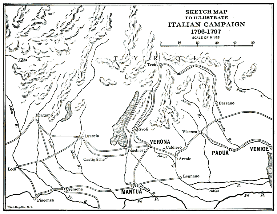
Description: This map depicts significant locations during Napoleon's campaign in northeastern Italy (1796–1797), including Lodi, the siege of Mantua, battle sites of Castiglione, Lonato, Roveredo, Bassano, and Caldiero, Arcole, and Rivoli (1797) along the River Adige.
Place Names: Italy, Verona, �Venice, �Padua, �Mantua, �Legnano, �Caldiero, �Bassano, �Rivoli, �Cremona, �Bergamo, �Tren
ISO Topic Categories: society
Keywords: Sketch Map to Illustrate the Italian Campaign, historical, �physical, kNapoleonicWars, physical features,
topographical, other military, society, Unknown,1796–1797
Source: Lucius Hudson Holt, A Brief History of Europe From 1789 to 1815 (New York, NY: The MacMillan Company, 1920) 168
Map Credit: Courtesy the private collection of Roy Winkelman |
|