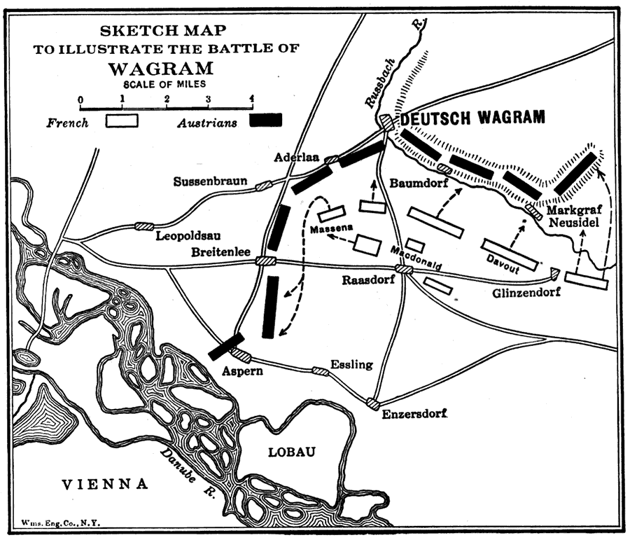
Description: A map of the Battle of Wagram, near Vienna, fought 5–6 July, 1809, was a decisive victory for Napoleon over the Austrian Army, effectively bringing an end to the War of the Fifth Coalition.
Place Names: Austria, Vienna, �Deutsch Wagram, �Aderlaa, �Essling, �Sussenbraun, �Enzersdor
ISO Topic Categories: society,
inlandWaters
Keywords: Sketch Map to Illustrate the Battle of Wagram, historical, �physical, kNapoleonBonaparte, kNapoleonicWars, physical features, other military,
historical event, society,
inlandWaters, Unknown,1809
Source: Lucius Hudson Holt, A Brief History of Europe From 1789 to 1815 (New York, NY: The MacMillan Company, 1920) 266
Map Credit: Courtesy the private collection of Roy Winkelman |
|