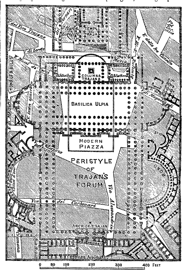
Description: A plan of the Forum of Trajan in Rome. The map shows surrounding roads and buildings, and details the Temple of Trajan, Columna Trajana and libraries, Basilica Ulpia, and the Modern Piazza. "The forum of Trajan with its adjacent buildings was the last and, at least in size, the most magnificent of all; it was in progress from 100 to 117." — Kellogg, 1903
Place Names: Italy, Rome, �Forum of Trajan, �Basilica Ulpia, �Arch of Trajan, �Columna Trajana, �Via Alessandrina, �Via del Carbonar
ISO Topic Categories: location,
structure,
transportation
Keywords: Forum of Trajan, physical, �political, �transportation, �historical, kAncientRome, physical features, roads, location,
structure,
transportation, Unknown,AD 100–117
Source: Day Otis Kellogg, D. D. , The Encyclopedia Britannica Vol. XX (New York, NY: The Werner Company, 1903) 826
Map Credit: Courtesy the private collection of Roy Winkelman |
|